Posts

Welcome / مرحباً

Image
This website is a fusion of 3 now extinct websites: discoversinai.net , sinaitrekkingandsafari.com and sinaigardens.net . Built on their content, this current site contains blog posts of different types (culture, nature, history, adventure etc...); information about hiking and safaris with routes and maps/Google maps/GPS coordinates; and information about the unique Bedouin orchards with a Google map.  Some of the information on the site might be interesting even for those who don't plan to visit, but there is also useful and practical information for those who do. It's a very visual site with lots of photos, and more is being added as old content is reposted on an ongoing basis.  Photos are not of professional quality, but some of them still came up nice and/or capture rare moments of life in the Sinai, be it tribal or natural events, or are unique in other ways. And they are all free to use - see more on conditions .  Those who are serious about hiking, trekking, camel...

Two short walks near St Catherine: Wadi el Arbain and Wadi Talaa

Image
  Looking at Jebel Safsafa and Wadi Shrij from the former Fansina building.  The route to Wadi el Arbain, also known as Wadi Leja, is via the steep Wadi Shrij under the Safsafa-Mount Sinai massif. There are Bedouin gardens along the way and in Wadi Arbain, as well as one of the ancient Orthodox monasteries known as Dier el Arbain or the Monastery of the Forty Martyrs. 

A long walk near St Catherine: the remote Wadi Tinya and the waterpools of Kharazet el Shaq

Image
  The view of Mt Katherina, Egypt's highest peak, from El Zirri.  A long walk to visit the remote Wadi Tinya, starting from the main route from St Catherine via Abu Jeefa and Wadi Zawatin. From the latter, passing El Zirri, the route leads to the high pass of Iskikriya, and on the other side descends to Wadi Tinya. Locations worth visiting but not visited this time include Wadi Abu Tuweita and Wadi Sagr. Wadi Tinya drains to Kharazet el Shaq, a series of pools at the top of the very steep and long gully known as Wadi Shaq-Tinya, which connects to the end of Wadi Itlah. Two ways exist to the village of Abu Seils, and this time the adventurous little canyon, Ubugiya, was chosen. 

A short walk near St Catherine: El Freish and Wadi Itlah

Image
  The view of Saint Catherine from the ridge of El Freish.  The nearest Bedouin garden from St Catherine is El Freish, a secluded and cute basin with a single garden, separated from the city by a small ridge. The basin is also called Farsh Shama' - or Farsh Abu Aluan, named after the family who owns the garden. The basin drains to the junction of Wadi Qweiz-Wadi Talaa-Wadi Itlah. The latter is a straight and long valley with many gardens and a little Greek Orthodox church next to the Cave of St John the Ladder. Wadi Itlah ends at Wadi Shaq-Tinya, a steep gully coming from the high mountains, and from here you can also get back to St Catherine via the village of Abu Seila. 

More Bedouin gardens in the Sinai high mountains

Image
  The Garden of Oda in Wadi Shaq. Another walk in the Sinai high mountains, visiting some of the previous locations as well as new ones, focusing on the beautiful Bedouin gardens. The photos show Wadi Shaq, Wadi Jibal, Wadi Bulia, Abu Jidda, and Wadi Mathar. 

Bedouin gardens in the Sinai mountains in the autumn of 2024

Image
  The view of St Catherine from the Abu Jeefa pass, one of the gateways to the Sinai high mountains. The locations along this walk include Abu Jeefa, Islibet, Wadi Tubuq, El Ehded, Wadi Zawatin, Abu Jidda, Wadi Jibal, and Farsh Rummana. Even in this late in the autumn, the wadis and the gardens are still very green. Many people, among them new generations of gardeners, were up tending their orchards, as they view it as a guarantee for possible harder times. 

Geographical features: Jidda / Dyke (Dike)

Image
Originally posted on February 7, 2015 The whole southern tip of the Sinai Peninsula is a mountainous area, while the High Mountain Region proper, sometimes called the Central High Mountains, is the area in the middle around the town of St. Katherine. (See Google Earth screenshots below.) Up to 80% of the massif is granite of different types formed as far back as 600 million years, but there are also mountains that are made of newer, about 10 million year-old black volcanic rock. Sandstone and limestone are found north of the mountainous tip, forming surrealistic rock formations, sandy plains and eroded layered plateaus. In the mountainous area red granite and black volcanic mountains are often found together, as we can see with the Jebel Safsafa-Mt. Sinai, the Jebel Raba-Jebel Ahmar-Mt. Katharina or the Jebel Abu Mahashur-Jebel Abbas Basha ranges. In each case much of the mass of the mountains is made of hard and smooth red granite, but the famous peaks are actually softer crumbling bl...

Garden of Ramadan Abu Sayyed

Image
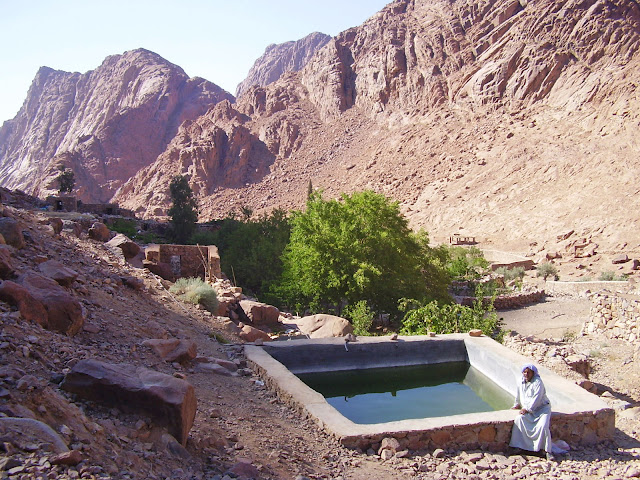
Very easy to reach from the town of St. Katherine, it lies just below the holy peaks of Mt. Sinai on one side and of Mt. Katherine on the other side. Mt. Sinai can be reached different ways, and the full day program is definitelly recommended. There is an ancient small Orthodox monastery next to the garden, with a big stone-walled orchard, olive groves, tall cypress trees. The rock of Moses is also in the same valley. Ramadan, the owner of the garden, sometimes plays the traditional stringed intrument, the simsimiyya. He also breeds Rock Hyraxes, a cute hairy mountain creature. The terraced garden has many secluded areas away from Ramadan's family tent, with stone rooms for winter use and shady-windy open arishas for summer. There are clean toilets and showers. There are many fruit trees, vegetables, herbs, all grown organically. The garden is ideal for individuals and smaller groups who want to relax on holy land but don't want to - or unable to - walk too much or too hard. ...

Dahab, South Sinai, peaceful as ever…

Image
Originally posted on January 14, 2014 Sunset over the Red Sea in Dahab — South Sinai is peaceful as ever…

Windows in the sky – Sinai aerial photos

Image
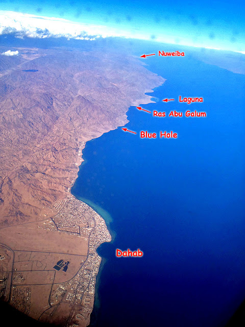
Originally posted on January 12, 2014 Flying to Sharm el Sheikh a couple of days ago over the Sinai, you couldn’t see the peninsula at all, it was covered with such a thick blanket of clouds. But as we got further south, just when we reached the edge of the Tih Plateau, small windows opened up in the clouds and luckily most of the main places of interest could be seen. Then further south and to the east above the Gulf of Aqaba the sky was totally clear, revealing the beautiful coastline. What a beautiful way to return to the Sinai!