Trek 22: From Coloured Canyon to Ein Khudra or the Nawamis area (3-5 days)
From the Coloured Canyon you could carry on to the oasis of Ein Khudra and the Muzeina region directly in a couple of days, or as suggested, along routes that include the Rainbow Canyon, Ein Umm Ahmed, Jebel Berqa and El Breqa. They take a bit longer, up to 5 days, but if you want more than just marching through long wadis, it is definitely worth the extra time. The longer routes are nice as they are and you can finish in the Ein Khudra or Nawamis area, but you can conveniently add other treks as well and carry on.
Read more: Rainbow Canyon, Ein Umm Ahmed, Wadi Zalaqa, Jebel Berqa and El Breqa.
You can click waypoints marked with a green camera symbol to see a photo taken at, near or of the given location.


Read more: Rainbow Canyon, Ein Umm Ahmed, Wadi Zalaqa, Jebel Berqa and El Breqa.
You can click waypoints marked with a green camera symbol to see a photo taken at, near or of the given location.
Trek in photos
waypoint 01: cafeteria/lodge at the top of the Coloured Canyon

waypoint 02: Ein Furtaga

waypoint 03: Wadi Ghazala junction

waypoint 04: Wadi Ghazala junction

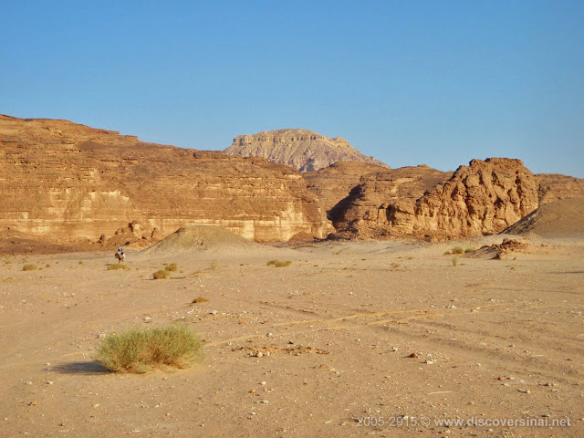
waypoint 05: approaching Ein Khudra

waypoint 06: shortcut to Smaila

waypoint 07: Wadi Arada, leaving Smaila behind

waypoint 08: path over to Wadi Biriya

waypoint 09: Bier Biriya a bit ahead, with the path going to the left up the cliff

waypoint 10: basin

waypoint 11: path up another cliff, and to the right

waypoint 12: path down on other side

waypoint 13: basin, with the Rainbow Canyon in the gap on the left

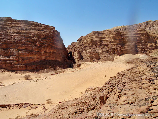
waypoint 14: inside the Rainbow Canyon

waypoint 15: end of Hlel el Waar, asphalt road in Wadi Watir

waypoint 16: entering Wadi Haramat

waypoint 17: Wadi Agula, reaching it over a shortcut over a ridge

waypoint 18: Wadi el Ein – Wadi el Breqa junction

waypoint 19: Warwara, entering Ein Umm Ahmed

waypoint 20: junction with Nawamis buildings

waypoint 21: path off from Wadi Zalaqa through gap to Jebel Berqa

waypoint 22: reaching the sandy plateau at Jebel Berqa

waypoint 23: entering the basin at the base of Jebel Berqa

waypoint 24: view back from the top of the gully

waypoint 25: path just below the top layer

waypoint 26: top of Jebel Berqa

waypoint 27: bottom of pass over to El Breqa

waypoint 28: entering El Breqa on the other side

waypoint 29: the view down from the top of El Breqa

waypoint 30: Wadi Halal junction

waypoint 31: the path up with the view of El Breqa in the background

waypoint 32: the path down with fork ahead

waypoint 33: reaching Wadi Khudra

waypoint 34: sandy plain at the base of Jebel Berqa

waypoint 35: Mabar Garib

waypoint 36: Naqb el Muahis

waypoint 37: Ras Smera

waypoint 38: Kitib Ahmar off Wadi Smera

waypoint 39: Kitib Abiad in Wadi Rum

waypoint 40: Wadi Rum lower part

waypoint 41: Wadi Zalaqa – Wadi Ghlim junction

waypoint 42: Wadi Ghlim – Wadi Umm Hamata junction

waypoint 43: Naqb Ghlim, with the view of the Nawamis area


